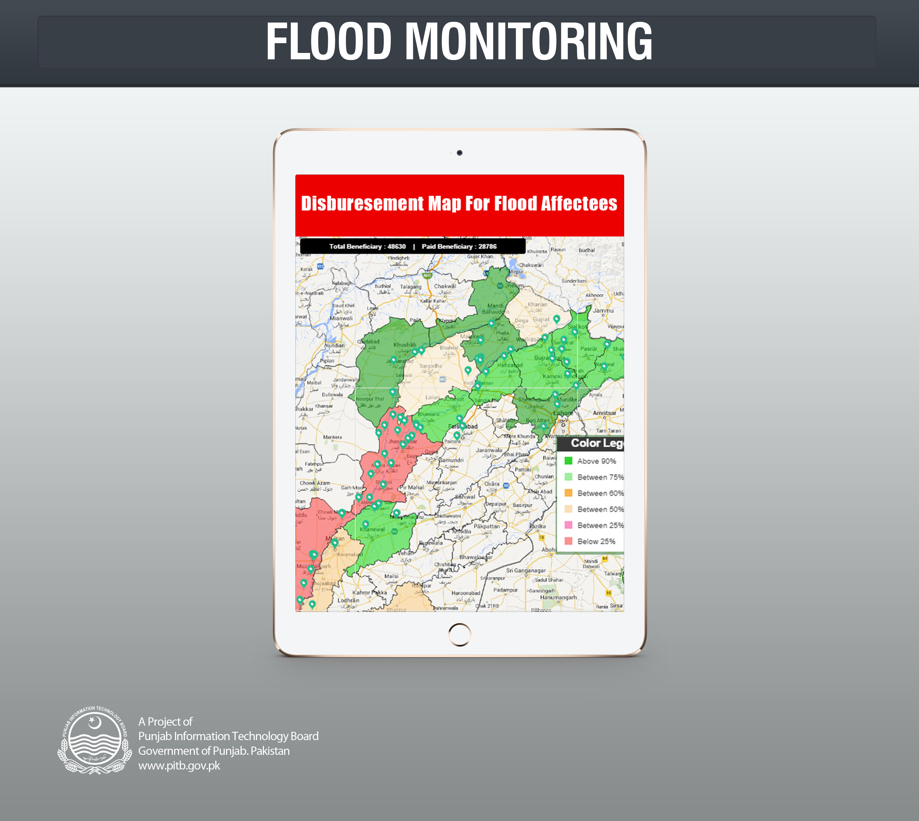
One of the most crucial issues that the government has had till the recent past was keeping up-to-date with the progress on flood relief development and work. To counter this issue, Punjab Information Technology Board (PITB) has developed a real time flood monitoring dashboard through the use of information technology. “This system helps keep a track of the latest flood development while keeping in loop all the concerned departments. Additionally, it further assists in managing the disaster in the shortest possible time span,” said a source at PITB.
The dashboard by PITB is updated with a disaster bulletin on hourly basis by PITB and concerned departments during the flood season. The bulletin has helped reveal the most recent flood stories by giving details about the flood affected areas, the injuries and the death toll. Flood Monitoring System has proved to be of great benefit to the government and flood relief organisations especially since it also highlights the development at the water works (be it the normal water flow or on an alert) along with situation of the roads. The Inundation Map in the system reveals the overall flood hit areas. Through this the government has been able to take real time relief and evacuation measures, hence, minimizing the possible chaos in such disastrous circumstances.